West Midtown’s Upper Westside has evolved into one of Atlanta’s most vibrant districts, with a growing number of restaurants, retail destinations, and entertainment spots. In response to rising traffic and parking concerns, the Upper Westside Community Improvement District (CID) has launched an interactive parking map to help visitors navigate available parking options more easily.
Highlights
- The Upper Westside Community Improvement District (CID) has launched an interactive parking map for West Midtown locations.
- The map helps drivers locate structured parking options across West Midtown.
- Users can also view locations that offer bike parking, EV charging, and other amenities.
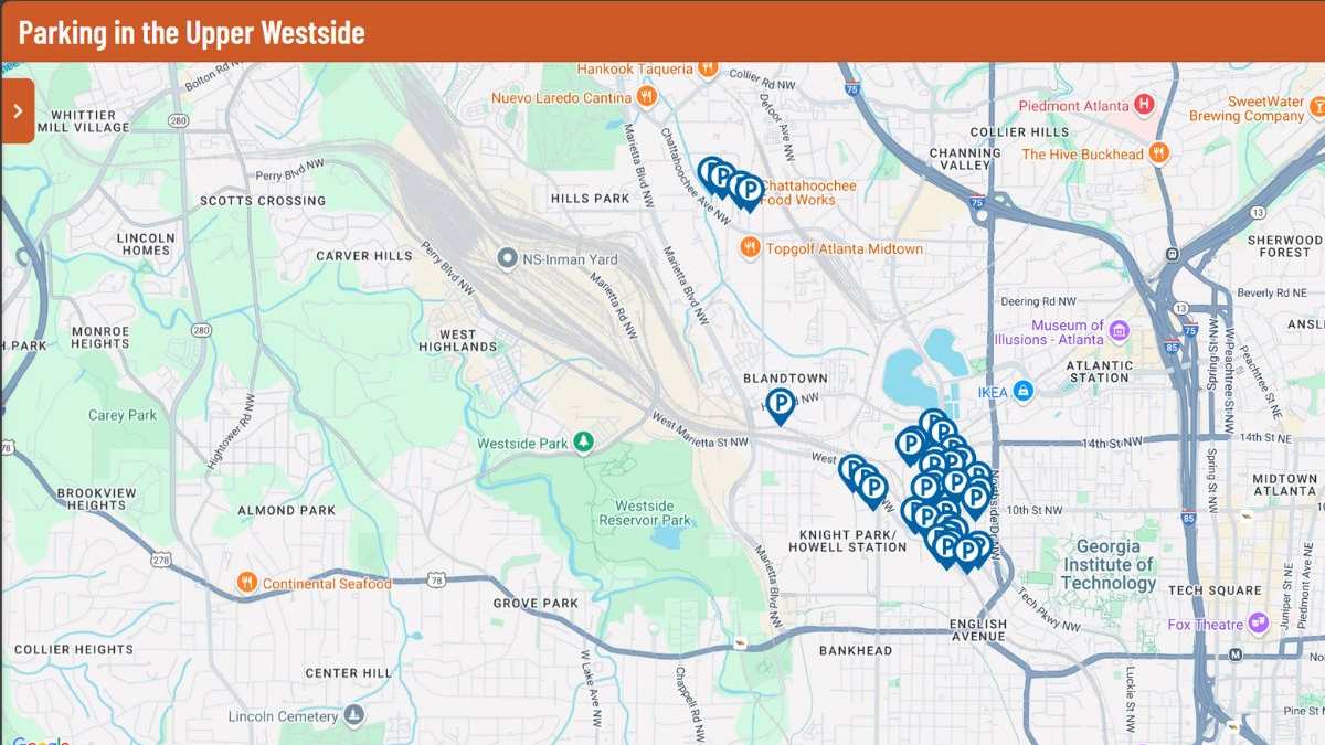
Upper Westside CID Launches a New Interactive Parking Map
In response to increasing congestion in West Midtown, the Upper Westside CID has introduced a new interactive parking map. With this tool, Atlanta locals can navigate structured parking facilities in the neighborhood.
The initiative also includes expanded parking validations and reduced rates at select locations.
Features of the Interactive Map
The map includes detailed parking information for key destinations along Marietta Street Artery, from The Works on Chattahoochee Avenue to The Optimist and nearby blocks. Featured locations include Star Metals and Westside Provisions District on Howell Mill Road.
The map shows which locations offer complimentary or business-validated parking. This helps locals find their preferred Michelin-rated restaurants and retail shops more easily than before.
The map also offers details concerning parking decks, which feature bike parking and EV charging.
Matt Bronfman, the CEO of Jamestown (part-owner of Westside Provisions District), said, “This is an area built on creativity and innovation. While there is abundant parking, we felt it would be helpful to support Upper Westside CID’s initiative to give patrons an easy-to-follow guide.”
Bronfman added that the map’s detailed pricing information makes it easier for visitors to plan trips. “The new map takes the guesswork out of parking costs, so planning visits to enjoy everything our shops and restaurants have to offer is effortless.”
Emphasis on the Marietta Street Artery neighborhood
The map includes rate information for locations ranging from The Works on Chattahoochee Avenue to The Optimist and nearby destinations. While doing so, its focus is heavily on the high-traffic area of Marietta Street Artery.
With its comprehensive benefits related to parking and traffic, the newest interactive map promises to support the growth of the Upper West Side.