
Central Atlanta Progress’s (CAP) 114-page concept study surfaced this week outlining a vision to convert a portion of the interstate highway into the project.
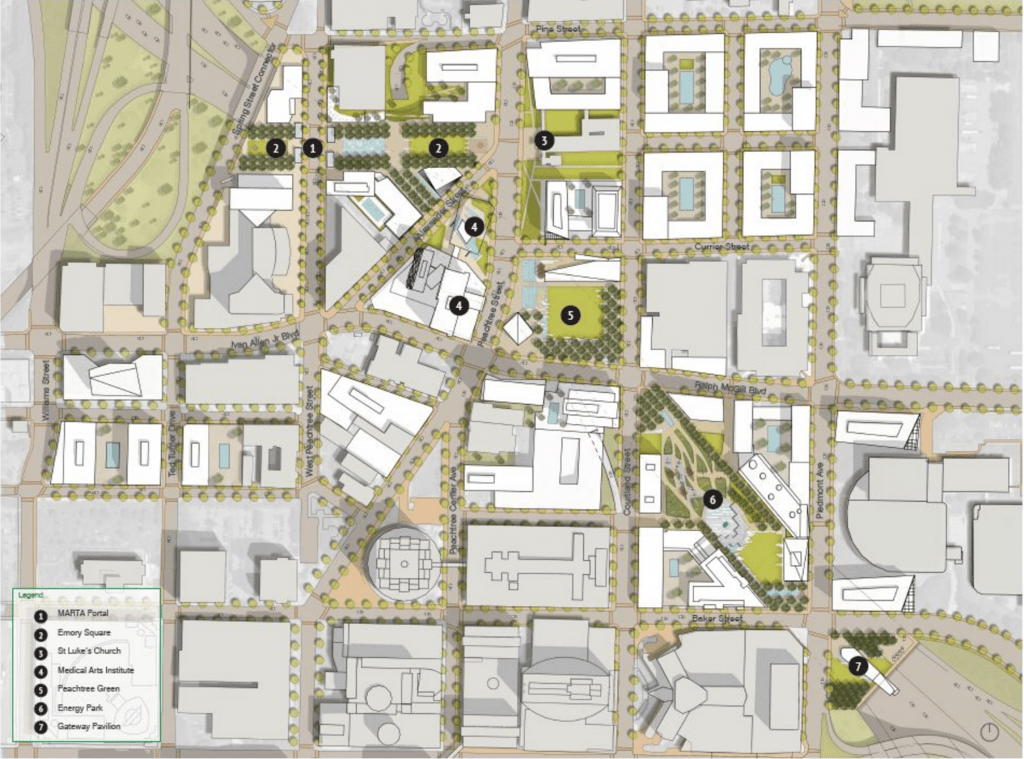
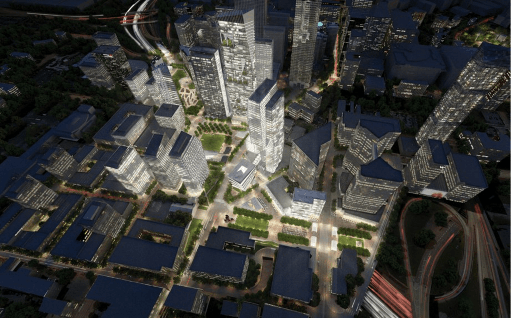
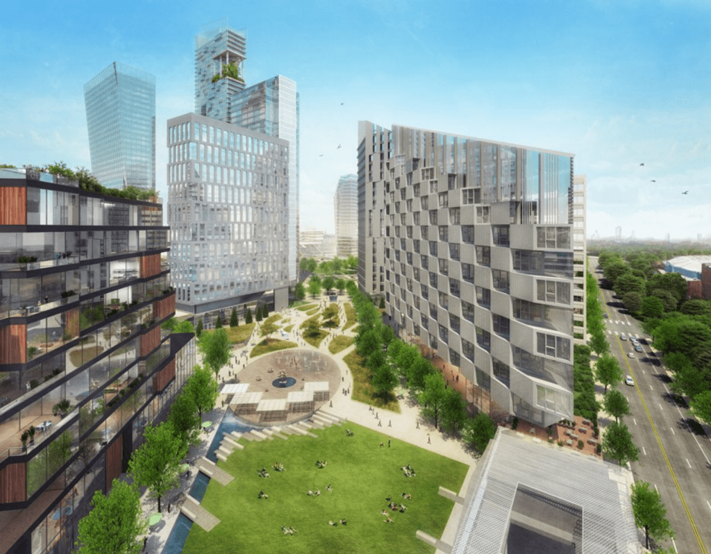
Plans this week surfaced for The Stitch, a project that envisions capping the Downtown Connector by constructing a ¾-mile platform over the highway, extending from the Civic Center MARTA station at West Peachtree Street to Piedmont Avenue.
Central Atlanta Progress (CAP) and the Atlanta Downtown Improvement District (ADID) have been leading the charge to advance the project, working with Jacobs Engineering to produce the initial concept study in 2015.
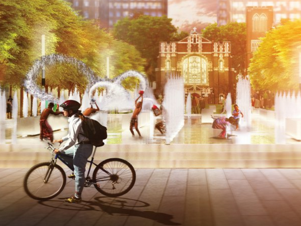
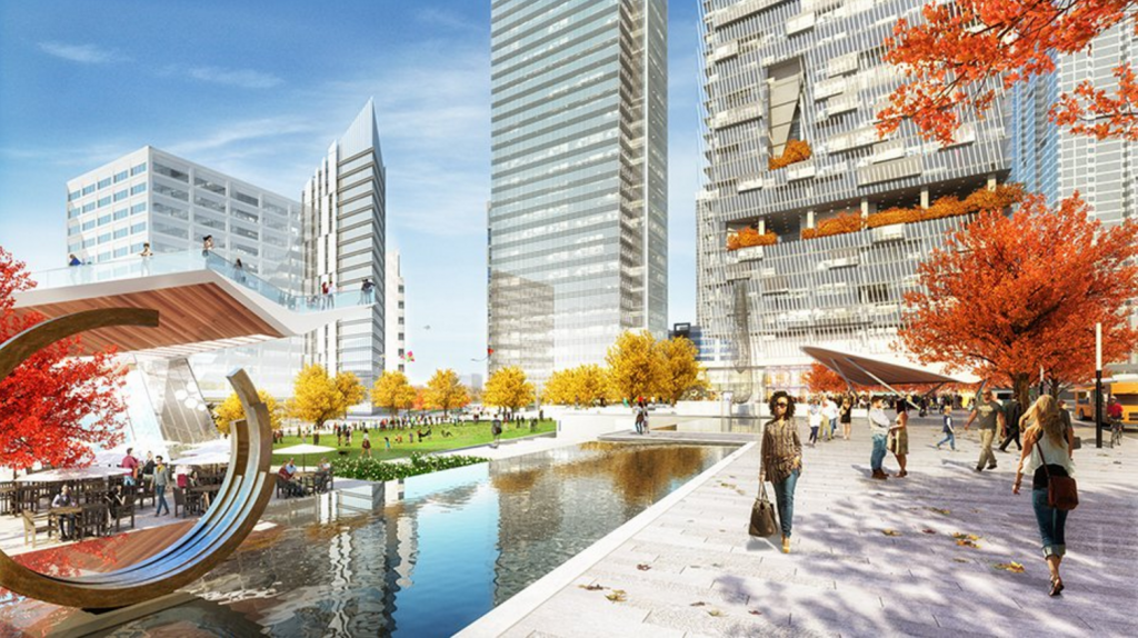
“This new space would create urban greenspace and foster new development both atop and adjacent to the platform,” according to CAP website. “The project will fill the void between Downtown and Midtown, disjointed years ago due to construction of the interstate.”
The Stitch gets its name from the “re-stitching” of the neighborhoods bringing “about a unified central business district for the City of Atlanta.”
The concept study imagined three “character zones” programmed with a variety of uses:
Here’s CAP’s concept study in its entirety:
A construction timeline for the $300 Million project has not been set as the project is still conceptual. Next steps to advance the vision of The Stitch include completing a detailed civil engineering survey, a technical feasibility study and a schematic design.


I have visited Klyde Warren Park in downtown Dallas; it has helped connect two sides of their downtown as this concept could do here in Atlanta. It also spurred a lot of condos and other retail in this otherwise unusable area.
Great looking project and totally transformative for downtown.
I really really love this idea. Not only for this stretch of the connector but for all of the connector. It only makes “urban” sense. What I would hope for is a clearer connection between spaces. You have two distinct and very strong geometries that inform the design; the underlayment of the connector and Peactree street. Both opposing curves. On top of these you have a grid of disconnected streets that need to be knitted together.
As a pedestrian, or a vehicle, experiences these space once must have an experience of these often conflicting geometries. Vertical component such as buildings must reenforce the street grids and enliven the sidewalks and green spaces. The green spaces must connect so that those using them can move between them.
For the MARTA plaza connecting the transportation portal with the Civic Center in whatever it becomes must be clear and direct, not stop at the St. Luke’s Church. That being stated, the church is a very strong organizer and symbol of that plaza. Consider Piazza Navona in Rome. You have this wonderful piazza with the 3 fountains and the central obilisk towards which the user can always have a sense of orientation. The church can do this, but a clear connection to the Civic Center should be made.
Consider also the High Line. The existing elevated rail is the connective tissue, but the buildings that are growing up around it also reinforce the city street grid and sometimes straddle the High Line.
Atlanta has not had a great history of urban development as a cohesive city. We can do great isolated developments but connecting them is where the real city lives and is made.
Best idea yet. that area is a no mans land. Phoenix did this years ago when the freeway came through